
Tropical Storm Priscilla Forms Off Mexico's Pacific Coast
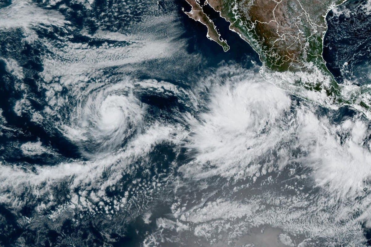
Tropical Storm Priscilla formed in the Pacific Ocean off Mexico's coast on Saturday afternoon, prompting the Mexican government to issue a tropical storm watch for southwestern coastal regions from Punta San Telmo to Punta Mita.
The National Hurricane Center (NHC) issued Advisory Number 1 at 2:00 PM MST, classifying Priscilla as a "large tropical storm" with tropical storm-force winds extending 140 miles from its center.
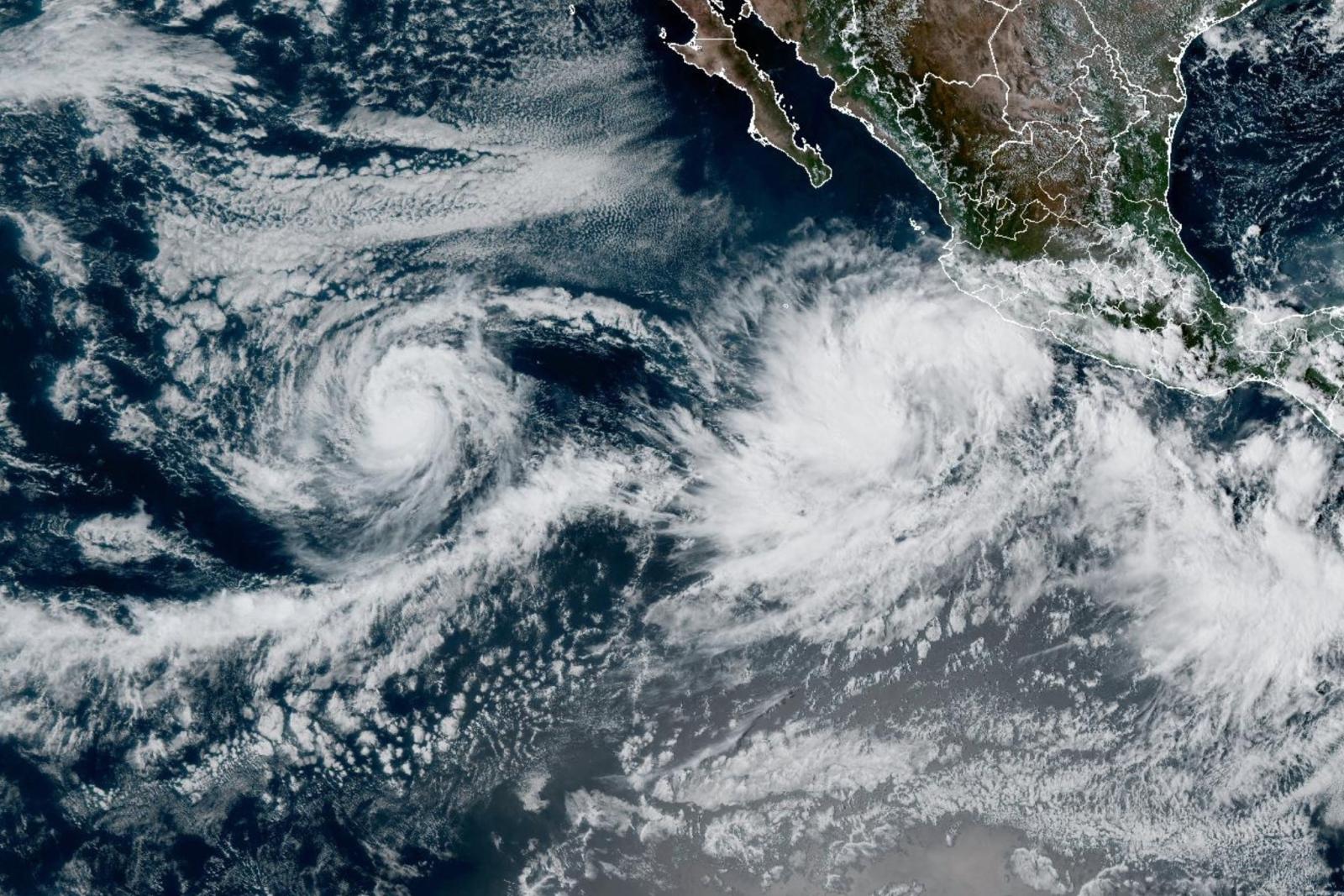
The storm represents the 16th named system of the 2025 Eastern Pacific hurricane season, arriving as another tropical system, Octave, continues churning in the open Pacific.
Why It Matters
The formation of Tropical Storm Priscilla poses immediate threats to Mexico's Pacific coastline during the peak of hurricane season. With the storm expected to strengthen to hurricane status by Sunday night while moving parallel to the coast, millions of residents in southwestern Mexico face potential impacts from heavy rainfall, life-threatening surf conditions, and tropical storm-force winds.
The storm's unusually large wind field and projected parallel track to the coastline could create prolonged hazardous conditions lasting several days, affecting major tourist destinations and agricultural regions during a critical harvest period.
What To Know
Current Position and Strength: As of Saturday's 2:00 PM MST advisory, Priscilla was centered near latitude 15.5 North, longitude 106.6 West—approximately 285 miles south-southwest of Manzanillo and 555 miles south-southeast of Baja California's southern tip. The storm carries maximum sustained winds of 45 mph with higher gusts and a minimum central pressure of 1002 millibars.
Movement and Forecast Track: Priscilla is moving northwest at 7 mph. The NHC projects a slow northward drift through Sunday, followed by faster northwestward motion beginning Monday. The storm's center is expected to remain offshore while tracking parallel to Mexico's southwestern coast through early next week, though any eastward deviation could bring more severe impacts to coastal communities.
Tropical Storm Watch Area: Mexican authorities have issued a tropical storm watch from Punta San Telmo to Punta Mita, where tropical storm conditions are possible within 48 hours. The NHC also advises interests in southern Baja California Sur to closely monitor the storm's progress, as conditions could deteriorate rapidly if the track shifts.
Rainfall Forecast and Flooding Threats: The storm's outer bands will deliver dangerous rainfall amounts across southwestern Mexico through Monday. Coastal portions of Michoacán and far western Guerrero face the heaviest totals of 4-6 inches, with isolated amounts reaching 8 inches. Colima, western Jalisco, and remaining coastal Guerrero areas should expect 2-4 inches. The rainfall forecast map shows a concentrated band of heavy precipitation along the immediate coastline, with the highest totals indicated in orange and red zones stretching from Guerrero northward through Michoacán.
Marine and Coastal Hazards: Life-threatening surf and rip current conditions are already developing along southwestern Mexico's coast. These dangerous swells will propagate northward, reaching west-central Mexico and the southern Baja California peninsula by Monday. The combination of large swells and potential storm surge poses significant risks to beachgoers and marine operations.
Hurricane Intensification Expected: Satellite-derived wind data supports forecasts calling for steady strengthening over the next 48-72 hours. Priscilla is expected to reach hurricane status—with sustained winds of 74 mph or greater—by Sunday night as it moves over warm Pacific waters.
What People Are Saying
National Hurricane Center's Key Messages Statement: "Heavy rainfall associated with Priscilla will impact coastal sections of southwestern Mexico through Monday, which could result in flash flooding, particularly in areas of higher terrain."
NHC Official Hazard Assessment: "Swells generated by Priscilla are affecting portions of the coast of southwestern Mexico and will reach the coasts of west-central Mexico and the southern Baja California peninsula by Monday. These swells are likely to cause life-threatening surf and rip current conditions."
What Happens Next
The NHC will issue intermediate advisories at 5:00 PM MST Saturday, with complete advisories following every six hours. These updates will provide refined track forecasts, intensity predictions, and potential adjustments to watches or warnings as Priscilla continues developing.
Meanwhile, Tropical Storm Octave continues meandering in the open Pacific with 65 mph winds but poses no immediate threat to land. The simultaneous presence of two tropical systems requires careful monitoring of potential interactions that could influence either storm's behavior.
Authorities urge residents throughout southwestern Mexico and the Baja California peninsula to monitor official sources for location-specific updates, as tropical storms can rapidly intensify and alter course with minimal warning.
Reporting from the Associated Press contributed to this article.